Now that I’ve caught you up on things like what we brought and what we ate, maybe I should tell you a bit about the hike itself.
First of all, we didn’t hike the whole trail. The most common starting point for this hike is to drive around to the Yukon side on the South Canol Road, which is maintained as a summer road. Due to COVID restrictions, going via the Yukon was not an option for us, which meant that we could start at one of the two landing strips on the trail: one at Mile 222 (near the Yukon border) and one at Mile 170, which is a hunting outfitter (Canol Outfitters, formerly Ramhead Outfitters). Everywhere else on the trail can only be accessed by helicopter.
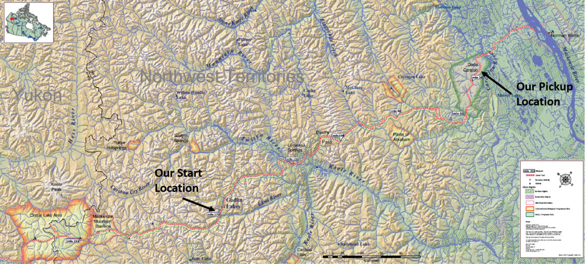
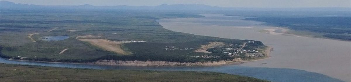
Our next consideration was pack weight. General guidelines are to make sure that your pack weighs less than 1/3 of your body weight. As a smaller person, that is basically impossible for a hike like this. Sam and I settled on a pack weight limit of 50 lbs for the trip. After some careful calculations, that meant that we could carry two weeks of food with us, making the shorter distance a more viable option if we wanted to avoid food drops. Most people who do this hike get two food drops (at Mile 170 and Mile 80), but that would have added to our already fairly substantial trip costs. So we decided to start at Mile 170 – we caught a flight to Norman Wells and then transferred to our charter flight into the wilderness.
Our arrival timing worked out pretty well for us, because it turned out that there was one other group hiking the trail this summer (3 people from Hay River), who had started at Mile 222 about a week before us, and around the time we were flying in, one of their team had developed an injury and needed to be flown out from Mile 170, so we were able to share a flight. The outfitters was closed for the summer due to the pandemic, so the only other people around for hundreds of kilometres were the other two hikers (Mila & PB).
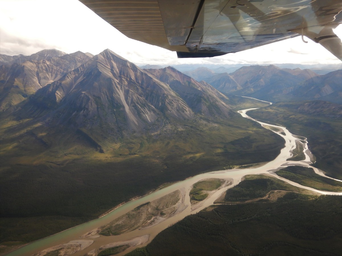
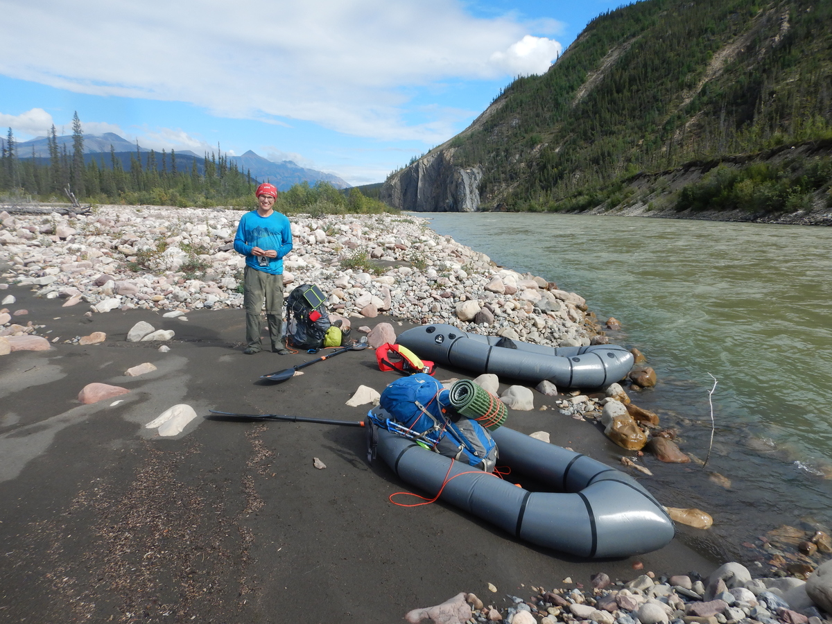
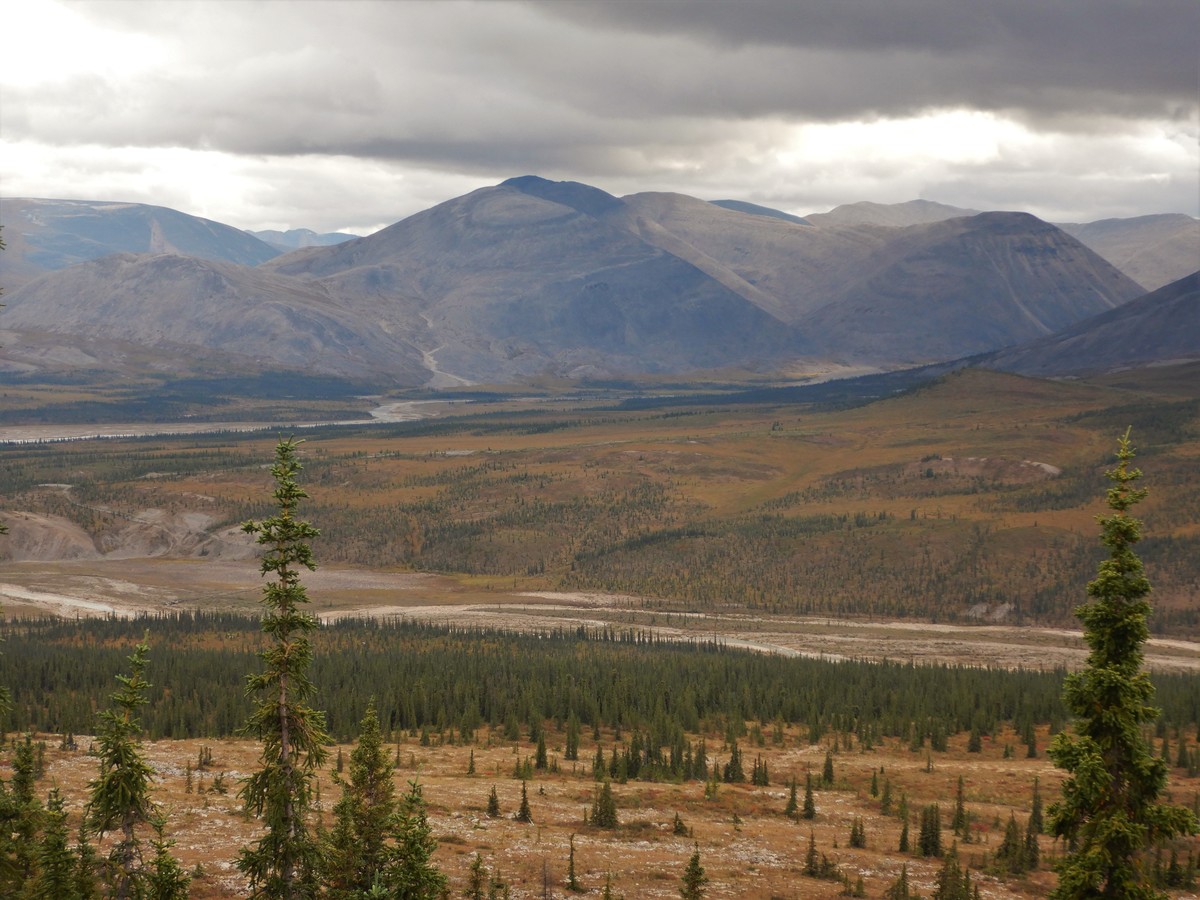
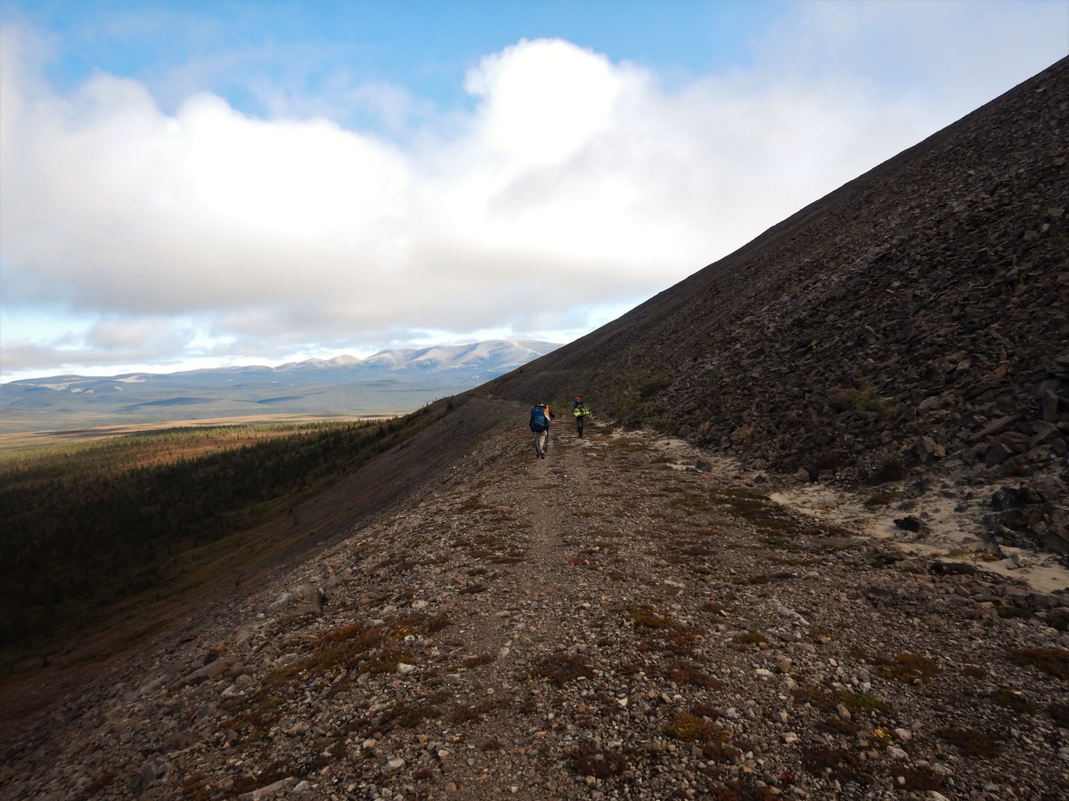
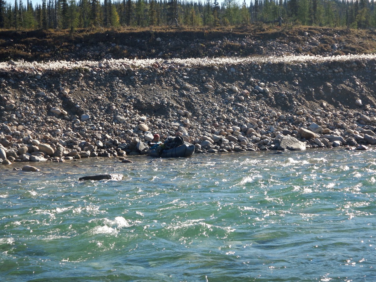
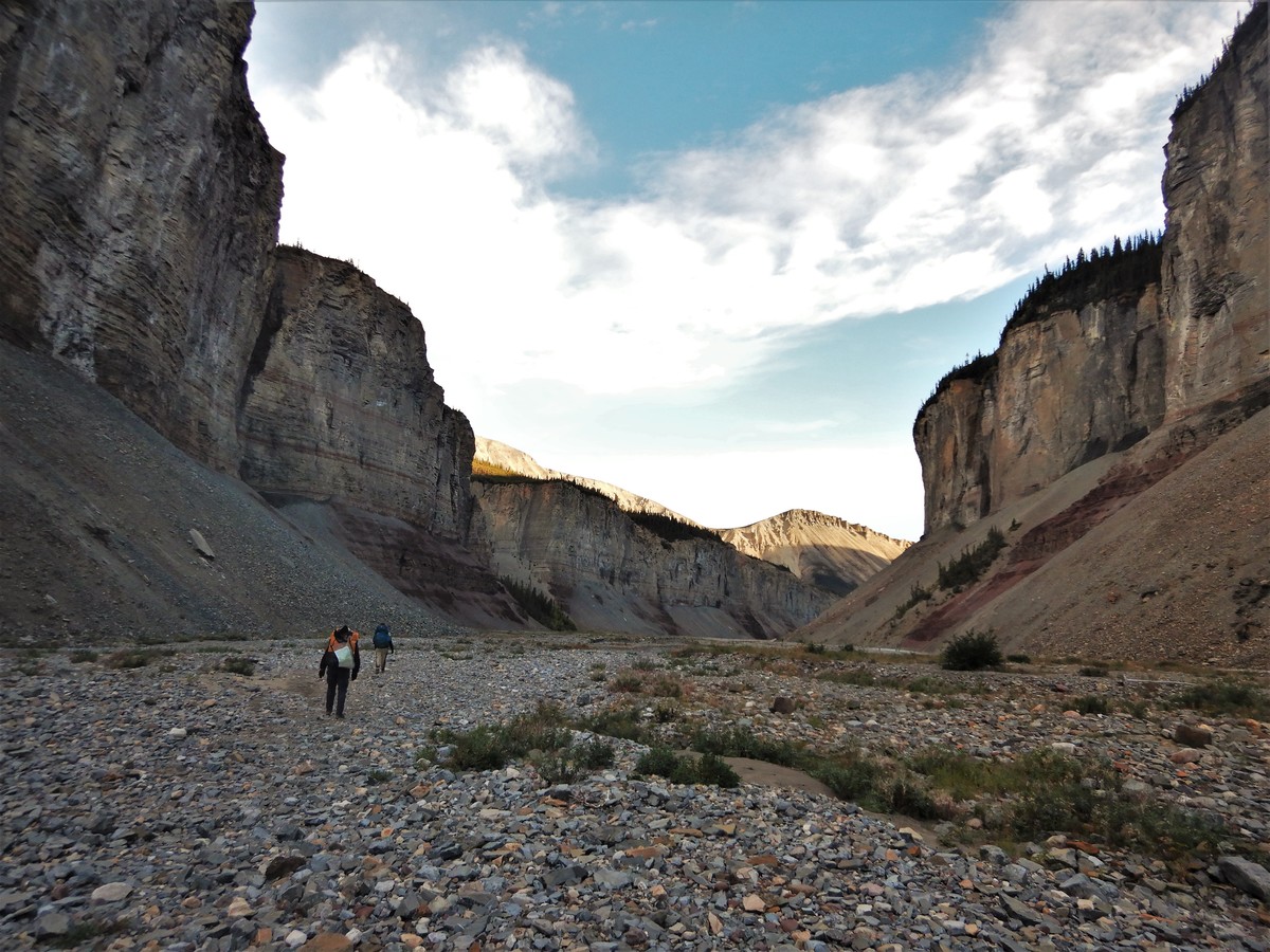
The first few days of the hike were pretty gruelling, mostly due to the weight of our packs. We were hiking long days and not putting on as much distance as we hoped (only about 15 km/day). The terrain wasn’t terrible (although often overgrown), and our weather was lovely, but the heavy packs made for slow travel and sore bodies. We tried packrafting down a few sections of the Godlin River to save some hiking distance, but shallow sections and sweepers across the narrow river forced us back onto the trail. Eventually the trail steered away from the Godlin River and towards the Twitya River, passing through a swamp around Mile 142 that we got lost in for a little while. The Twitya was our largest river crossing of the hike, and we managed to cut off 5 km of trail by paddling down the river, which was an excellent perk of bringing the packrafts.
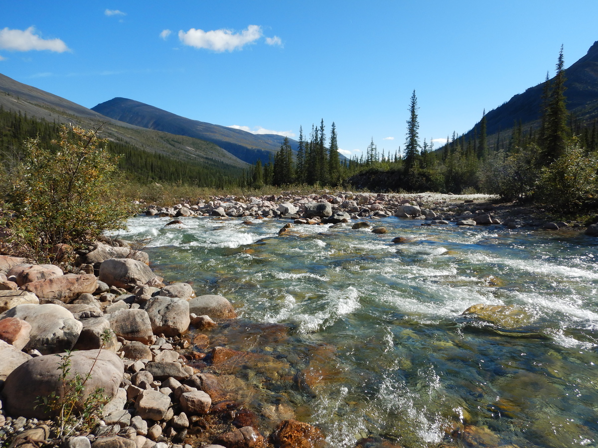
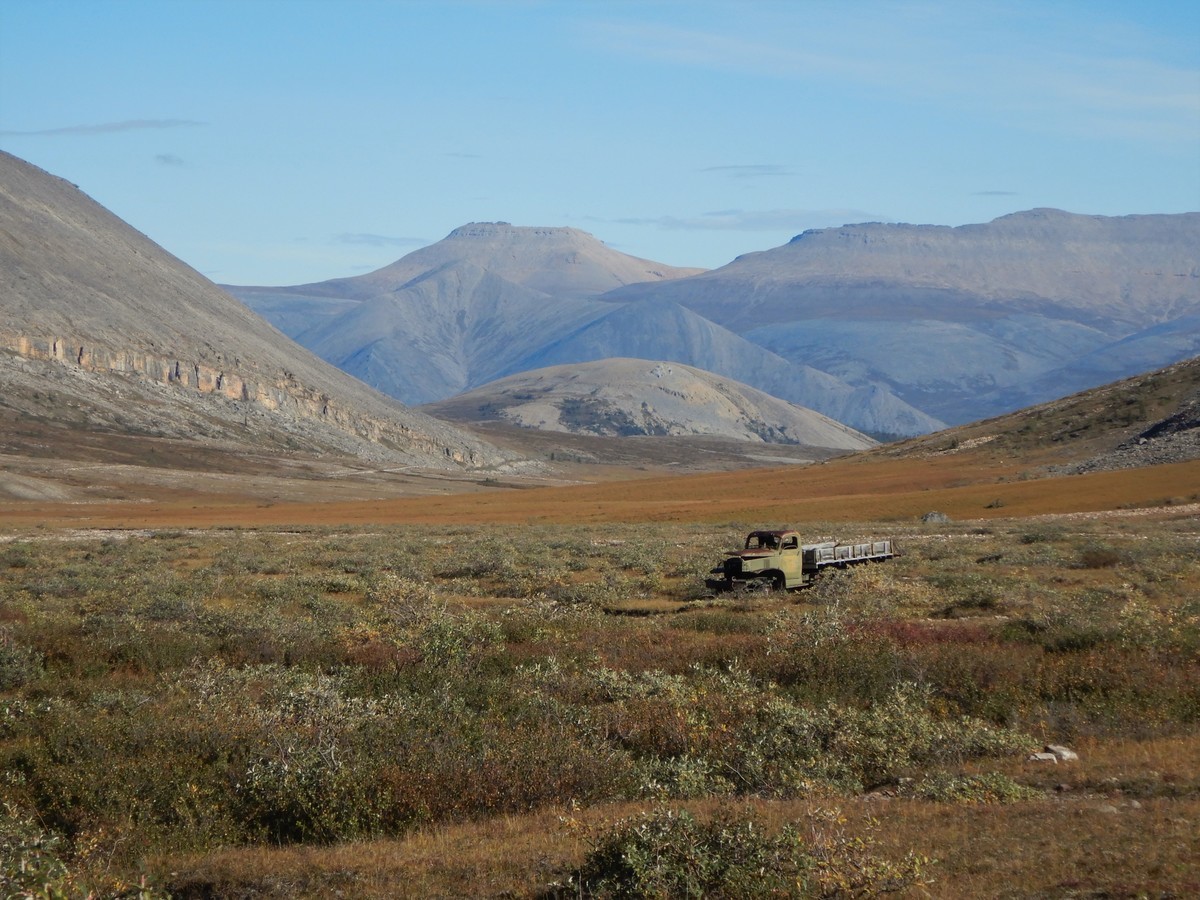
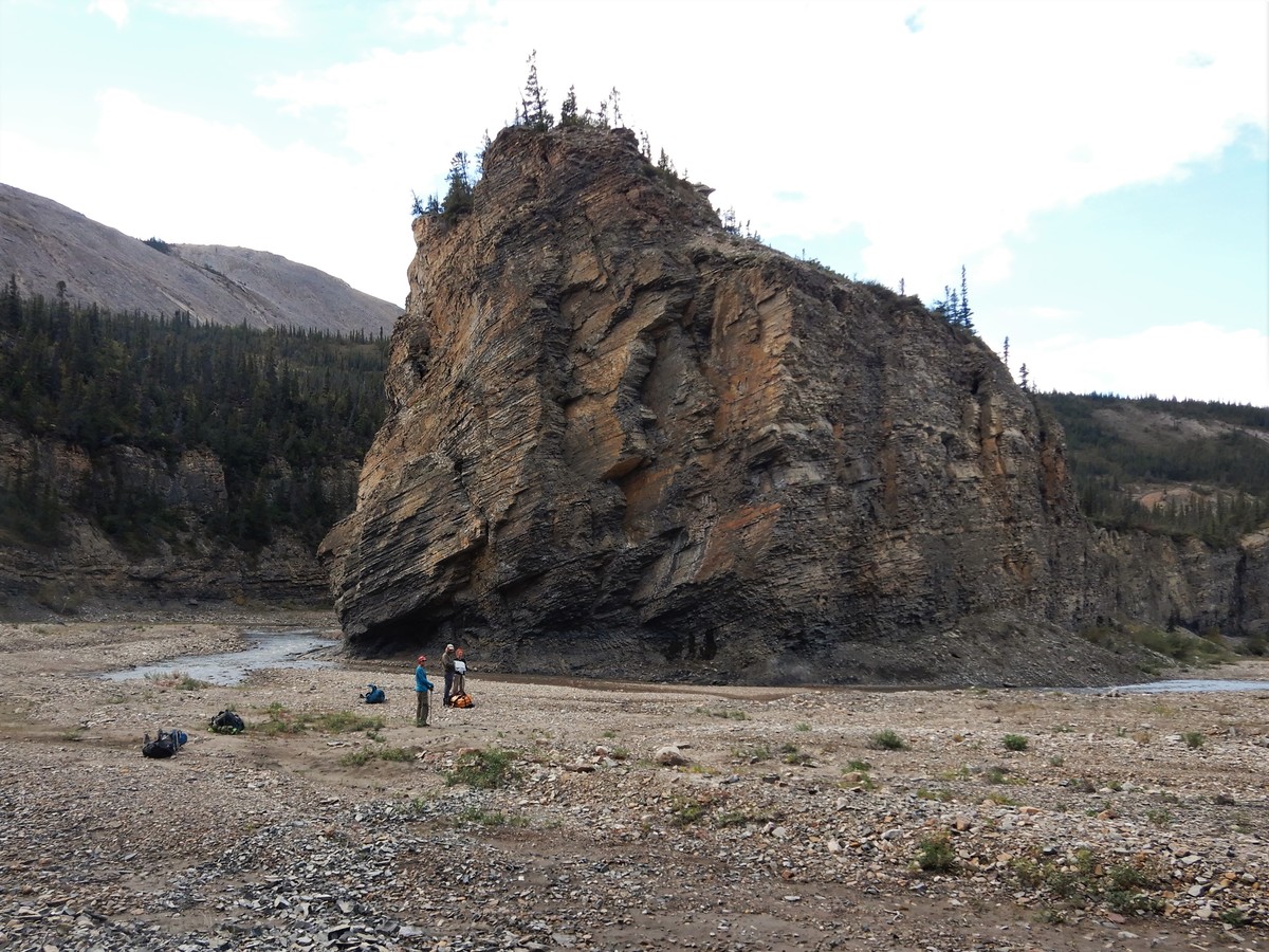
From the Twitya River, the trail followed Trout Creek up through Devil’s Pass. This was some of the most challenging terrain on the hike, with most of the trail being washed out by landslides and replaced with loose, rolling cobbles, and several dodgy creek crossings that were too shallow and rocky for packrafts, but were still almost waist-deep with strong currents. By the end of this section, I was starting to develop an ankle injury from days of walking on loose rocks, and both our GPS and backup GPS had broken. So things weren’t going our way, but at least the trail was scenic and our weather was still nice. We decided to message the other group to meet up with them, and caught up with them a bit after Mile 108 (Pump Station #4, one of the main sites with a bunch of old relics). This was 7 days in; we hiked with the other group for the rest of our trip.
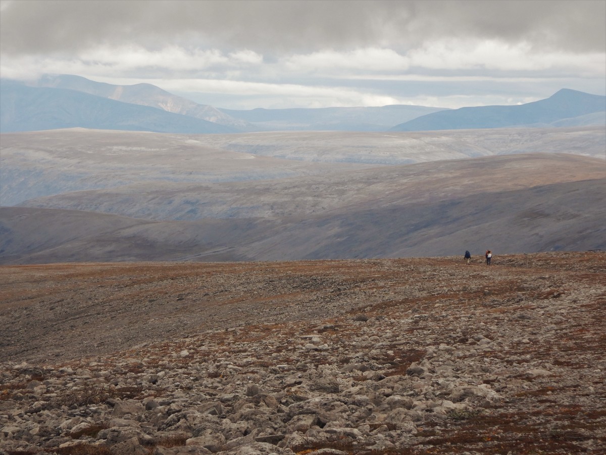
After a bit more ankle-crippling terrain, we got some respite on the wide open trail up to the Plains of Abraham. Of course this is also when our weather started to take a turn for the worse – not that we could complain after eight solid days of blue skies in the Mackenzie Mountains. We sat out a rainstorm next to some ruins at the top of the plateau. The other group picked up their second food drop at Mile 80 (their first was at Mile 170), replenishing their dwindling supplies.
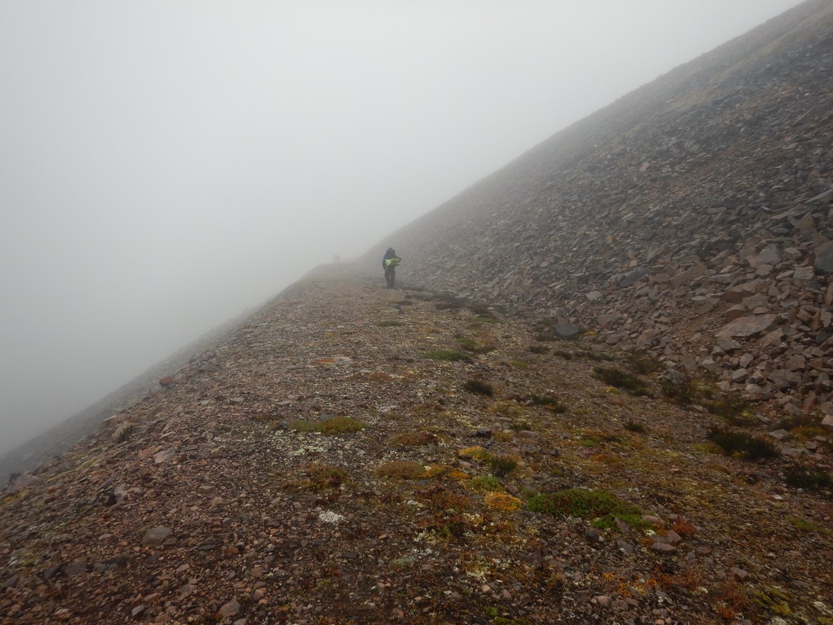
After coming back down to valley-level, we arrived at Blue Mountain and had a choice to make: the slightly shorter low road, with a high probability of more ankle-rolling washout sections, or the high road, which the map advertised as “worth it for the views”. We opted for the high road, which gradually became less of a “trail”, and more of a “bushwhack along a cliff edge”. This was also when our weather hit its worst point on the trip, leaving us completely fogged in on the mountain.
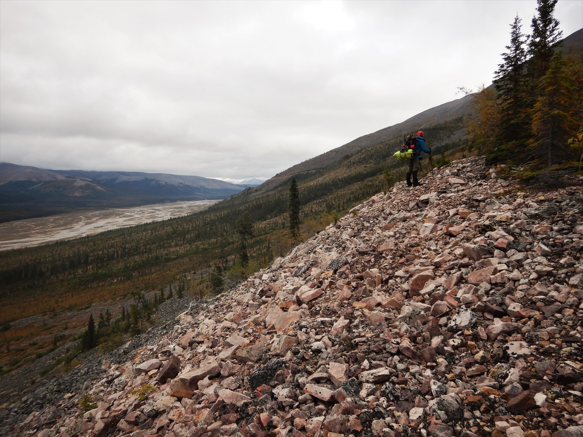
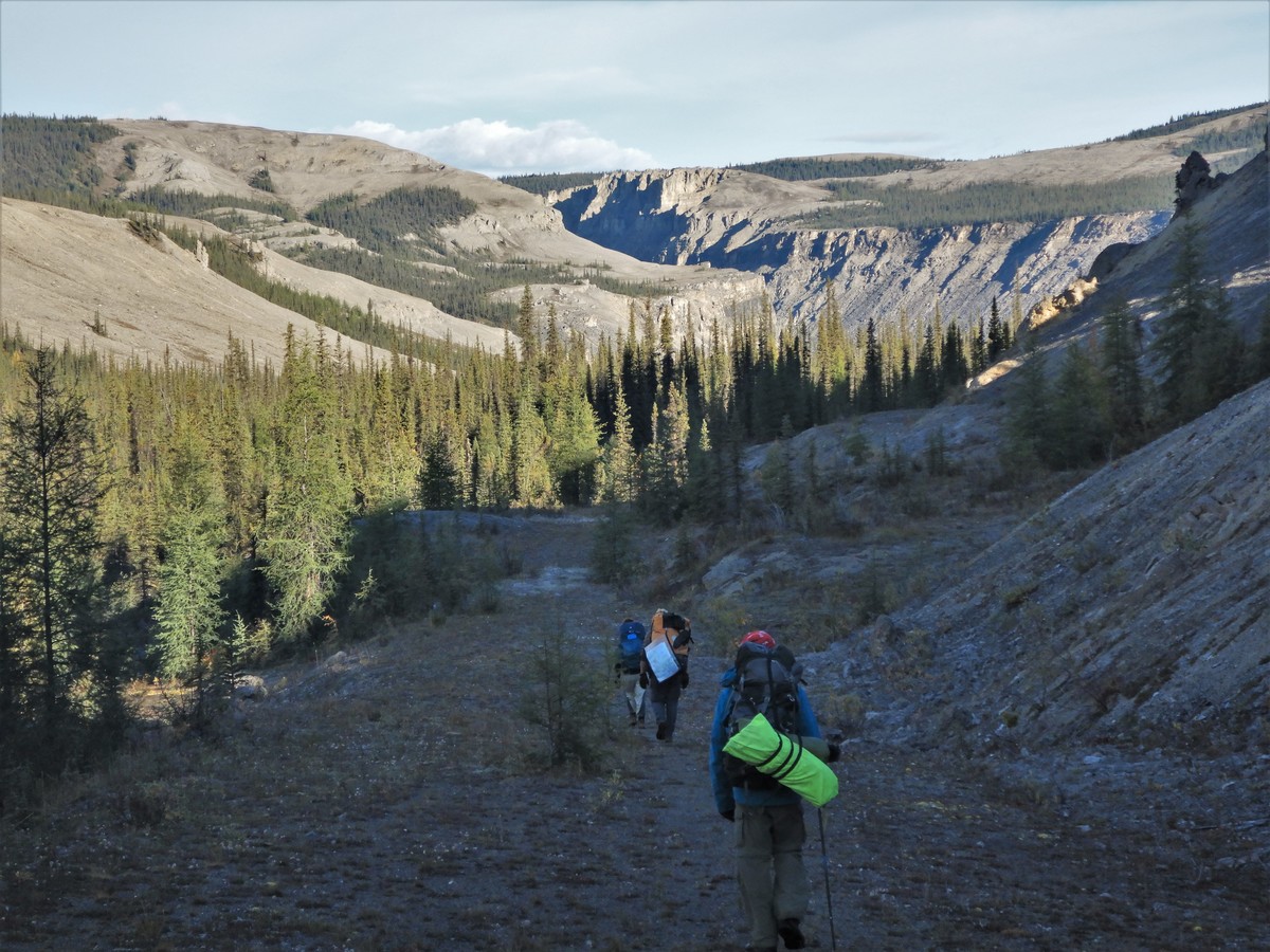
After Blue Mountain, the trail conditions improved and our sun came back. By this point, our packs were nice and light and my ankles were much improved. We crossed the Little Keele River around Mile 50, which was our second and last major river crossing (since our route involved us skipping the Ekwi and Carcajou crossings).
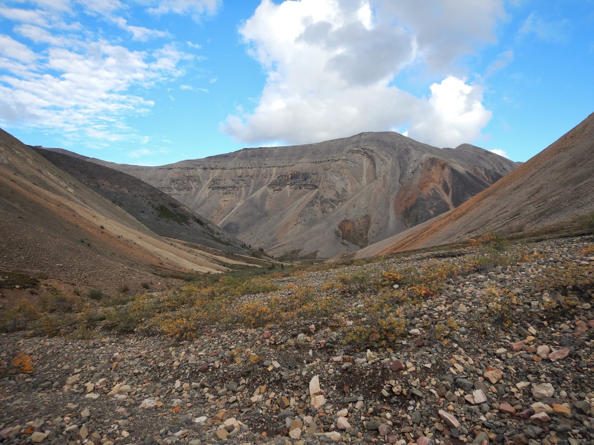
After the Little Keele River, we started heading into Dodo Canyon, which is one of the more scenic sections of the hike. The trail is completely washed away through the whole canyon, so it was back to loose rocks and frequent stream crossings.
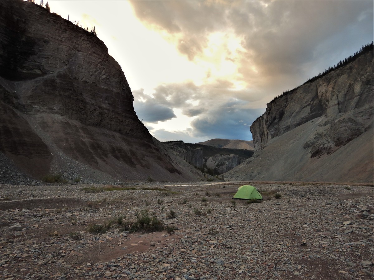
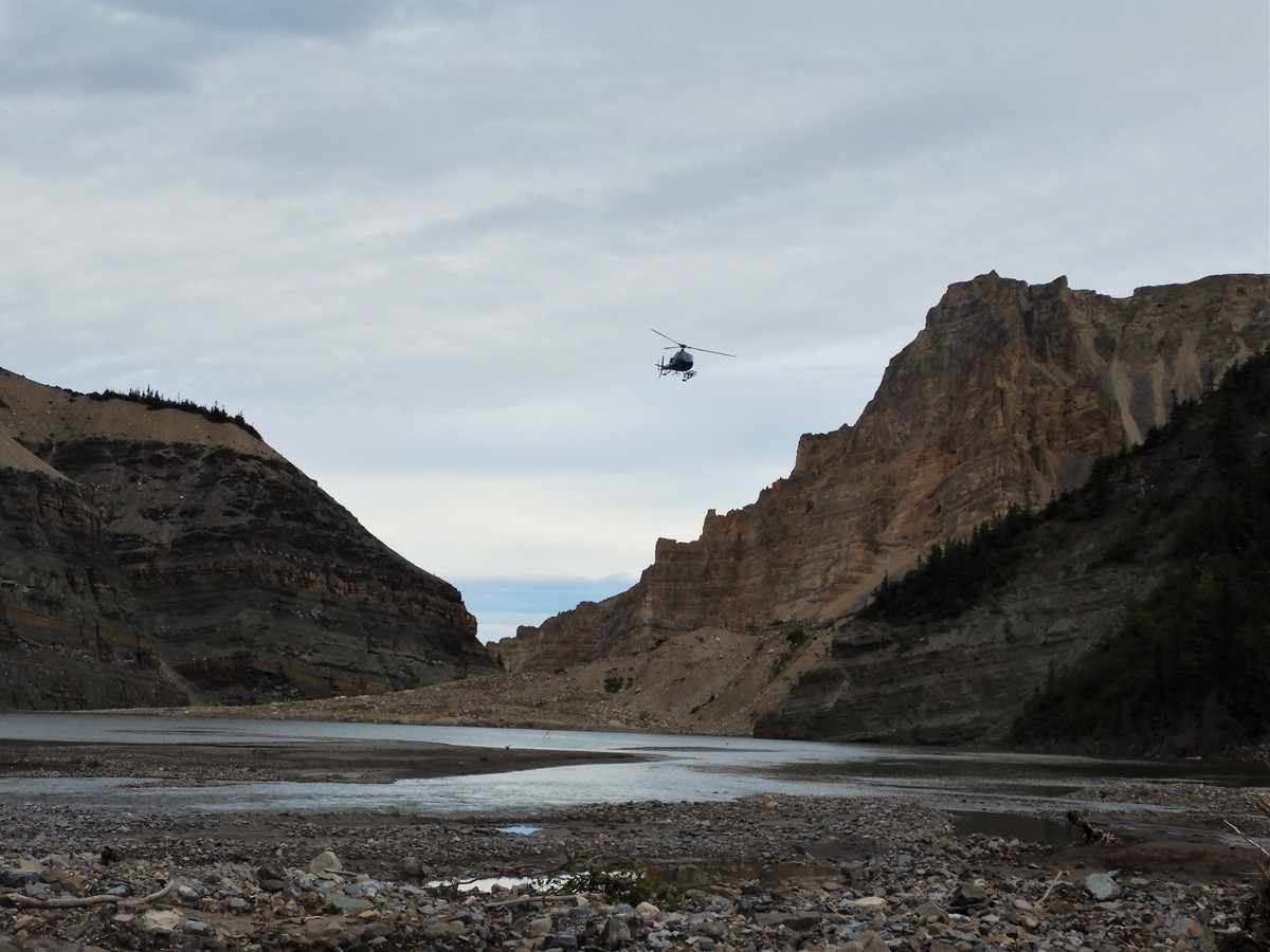
The last 30 miles or so (about 2.5 days) of the hike are through a lowland swamp that no one has anything good to say about. During the trip planning phase, I had the brilliant idea to get a quote for a helicopter pickup, and it was a reasonable price, so we decided to skip the swamp. After trekking through the Boneyard swamp, the other hikers had decided to join us for our pickup, so the four of us got picked up in Dodo Canyon for a quick flight back to Norman Wells, saving ourselves from the gruelling swamp trudge ahead.
Maybe next year we’ll drive around to the Yukon and complete Miles 222 to 170 – I hear that it’s a very nice section with a well-defined trail.