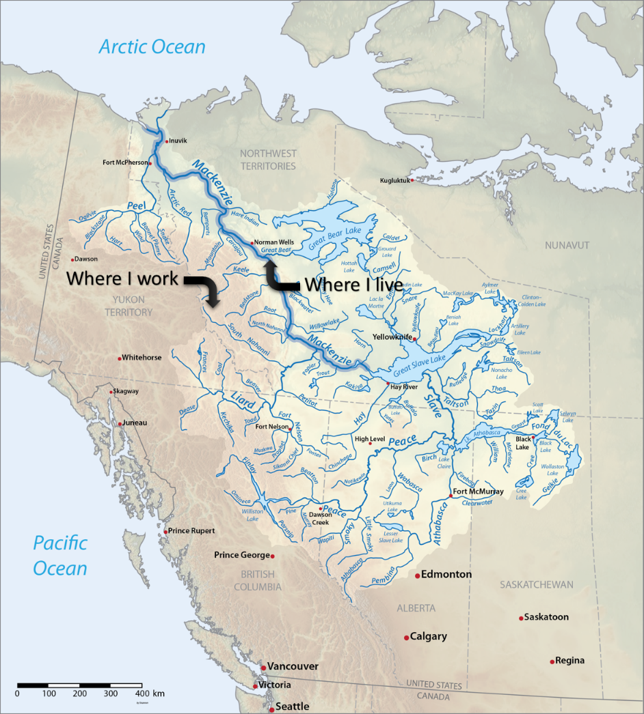
The Mackenzie River is the longest river in Canada (10th longest in the world), running 4,241 km from the Great Slave Lake to the Arctic Ocean. Its watershed is the largest in Canada, encompassing 20% of the country, but only about 1% of the population. The river discharges more than 325 cubic kilometres of water each year, accounting for roughly 11% of the total river flow into the Arctic Ocean. Here is a map of the watershed:
The entire main stem of the Mackenzie River is undammed. The Government of Canada Water Office has a records of the daily flow rates since 1943 and water levels since 2002, which I have graphed for your convenience.


Let’s zoom in onto one year to see what’s going on.
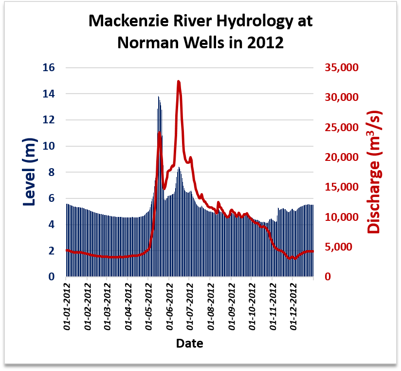
The ice break-up on the Mackenzie occurs in May, with peak flow between May-July. Water levels peak sharply in May for a brief period of time.